Showing posts with label Quantock. Show all posts

Monday, February 19, 2007

Trail watchers can help look after the Coleridge Way

A SCHEME which encourages local residents to help look after public rights of way is being extended to include the Coleridge Way through West Somerset.
The Coleridge Way stretches 36 miles across the Quantock and Brendon Hills over Exmoor, linking Nether Stowey with Porlock.
It celebrates the landscape which inspired the works of one of England’s best-known poets, Samuel Taylor Coleridge.
Coleridge wrote works such as Kubla Khan, The Rime of the Ancient Mariner, and Frost at Midnight while living in Nether Stowey.
His presence attracted other poets, such as William Wordsworth, to the area and inspired the film Pandemonium, directed by Julien Temple, who lives in Holford.
Residents of West Somerset can now ‘adopt’ their favourite section of the Coleridge Way and help Exmoor National Park Rangers and Somerset County Council’s rights of way team to look after it.
It is part of the county council’s Trail Watchers scheme which was launched last summer on the River Parrett Way.
County council community and volunteer development officer Grant Turner said: “We ask Trail Watchers to walk the section they have adopted three or four times a year and let us know if they come across any problems such as a broken stile or gate, missing signposts, or overgrown paths.
“We can then work with landowners to quickly resolve any problems and make sure the trail remains open and easy to use for everybody to enjoy.”
County portfolio holder for planning, transport and waste, Councillor Hazel Prior-Sankey, said: “The Coleridge Way has attracted a huge number of visitors to the county from far and wide since opening in 2005, and has helped support a number of small local businesses.
“It is a jewel in Somerset’s rights of way crown and, thanks to the Trail Watchers scheme anybody can now get actively involved in helping to look after it.”
The Coleridge Way is supported and funded by a partnership including West Somerset Council, Exmoor National Park Authority, Quantock Hills Area of Outstanding Natural Beauty, and ARTlife.
A survey of businesses along the route has shown more than 60 per cent were experiencing significant economic benefit from walkers.
On the back of the success of the walking route, one new B&B has set up, baggage transfer services have been established, and several companies and hotels offering walking packages now include the Coleridge Way.
Anybody who wants to join the Coleridge Way Trail Watchers scheme should contact Grant Turner on 01823 356156 or visit www.somerset.gov.uk/rightsofway.
The Coleridge Way also has its own website at www.coleridgeway.co.uk.
  • Our photograph shows ‘Trail Watcher’ Ian Thompson (left) receiving his Coleridge Way Trail Watchers pack from county rights of way community and volunteer development officer Grant Turner, watched by Coleridge Way trail officer Alan Martingell. Photo by Heather Lowther, ENPA.

Monday, November 06, 2006

Uncovering Roman history of Quantock Hills

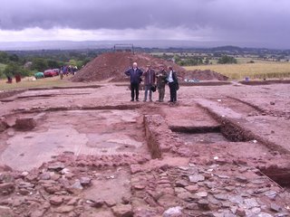
EXCITING results from the largest archaeological surveys yet carried out in Somerset have provided a new picture of how the Quantock Hills have been used and managed over the past 5,000 years.
The surveys, carried out by English Heritage and the University of Winchester, in conjunction with Somerset County Council’s heritage team and the Quantock Hills AONB service, took more than six years to complete, with more than 300 students and local volunteers taking part in archaeological digs on six separate sites around the Quantocks.
The results from these extensive studies culminated in a presentation to 100-plus interested people in Crowcombe Village Hall, organised by the Quantock Hills AONB service.
The Lord Lieutenant of Somerset, Lady Elizabeth Gass, who lives on the Quantocks, introduced the presentation, where speakers from the three key organisations explained how the landscape of the hills had changed and described some of the results from the surveys.
County council archaeologist Bob Croft said: “The oldest finds were flint arrowheads dated from the Neolithic period found in the Cothelstone area and also at Yarford and Volis.
“The oldest feature discovered is a Beaker period pit in Volis dating from the Bronze Age, approximately 4,000 years ago, so-called after the distinctive pottery vessels buried on these sites.”
An English Heritage spokesman told of its completed archaeological field survey which mapped all the visible earthworks and heritage features in the Quantock Hills AONB.
In addition, its survey examined some of the main historic estates and medieval sites, such as Kilve Chantry and Lilstock Harbour.
Hazel Riley, from English Heritage, said: “We have mapped and recorded the visible heritage throughout the AONB area and discovered a wide range of new archaeological sites from prehistoric cairns through to defensive remains from the Second World War.
“Our work at Kilve Chantry has helped with the interpretation of this important medieval manor house and its surrounding landscape.
“The Quantock AONB survey has shown the value of field survey along with aerial photographic work to map the changing landscape.”
The findings will be published in a new book titled ‘The Historic Landscape of the Quantock Hills’, which is being launched during November.
These new sites, along with all the information from the English Heritage survey, will also be mapped on to the Somerset Historic Environment Record.
The finds at Yarford are of the most interest to the archaeologists.
A large prehistoric site dating from Iron Age times, c500BC, was later occupied by a substantial Roman villa, which dated from the mid 4th century AD with a fine mosaic floor in the main room.
This is one of the most westerly villas with mosaic floors yet found in Roman Britain.
The villa was subjected to three seasons of excavation but is now safely re-buried to protect it for the future.
Dr Keith Wilkinson, from the University of Winchester, said: “This was an unexpected and exciting discovery and was an important and significant site on this part of the Quantock Hills.
“If there is one villa, then the chances are that others will be found in due course.”
Chris Edwards, Quantock Hills AONB manager said: “The long-term management and care of the Quantock Hills AONB will require a greater understanding of what we have inherited and what we are to pass on to subsequent generations.
“Greater understanding and appreciation of the landscape is one of the key elements of the AONB management plan.”
County council portfolio holder for adult and community services, Councillor Justin Robinson, said: “These projects have shown the value of partnership working and the need for detailed surveys, linked with archaeological digs.
“We are now starting to understand a little more about what has happened on the Quantocks in the past and how these events have shaped the landscape we use and cherish today.”
The University of Winchester’s project focused on the spread of archaeological crop marks along the southern edge of the Quantock Hills from Bishops Lydeard in the west to North Petherton in the east.
Local co-operation with the project has been strong and several local landowners including the Cothelstone and Tetton estates have been very supportive.
In conjunction with English Heritage’s field survey, Helen Winton, of English Heritage, has co-ordinated analysis and detailed mapping of aerial photographs within the AONB.
As part of this survey, more than 100 new sites have been added to the county records.
A leaflet about the surveys, called ‘Recording and Understanding the Historic Landscape of the Quantock Hills’, is available from the Quantock Hills AONB Service. The telephone number for the service is 01278 732845.
  • Our photograph shows part of the mosaic found at the Yarford Villa, which has since been reburied to protect it.